-40%
Owens Valley GOLD mines, Lone Pine, Inyo, Calif, rare 1st ed, big SEPARATE map !
$ 31.55
- Description
- Size Guide
Description
Scarce 1st ed. report locates old gold & silvermines in Inyo Mountains, near Owens Valley, CA
Report and maps also pinpoint where UNMINED
gold and silver are still waiting to be mined!!!
In mountains above Lone Pine, Keeler, near Cerro Gordo
T
his is the ONLY full-length modern government report about gold and silver mines in the Russ Mining District, in the Inyo Mountains above Owens Valley, near Lone Pine, California.
The red shaded areas have moderate potential for containing undiscovered lodes of gold and silver.
"Au" is the elemental abbreviation for gold. "Ag" means silver.
Very hard to find
As far as I know, this report has only been offered three times on ebay in the last seven years. I know because I sold all three copies. It takes me about two years to find a copy, so unless you want to wait another two years, you better grab this one while the grabbing is good.
Buy it now or forever hold your peace. Once it's gone, it's gone.
Predicts where
the gold is!
So what the heck is the big deal about this little report? Well, the first edition is harder to find than a snowball in Death Valley in July. But more importantly, it doesn't just tell you where old played-out picked-over mines are, it maps areas where gold and silver deposits remain untouched, just waiting for someone to come along and dig 'em up.
Don't confuse this report with another one about the Inyos that I have listed. That one is centered around the old Beveridge Mining District, mostly on the Saline Valley side of the Inyos.
This one covers the Russ Mining District (also known as the Lone Pine Mining District), mostly on the western side of the Inyos, nearer Owens Valley.
Of course, besides predicting where new deposits are, it also describes existing deposits and historic yields.
Covers 66 mines and prospects, both famous and forgotten
This 27,240-acre section of beautiful unpopulated wilderness contains more than 1,000 mine claims. This report covers 66 of the most important old mines — big and little, famous and forgotten, mines that made their owners rich and mines that have yet to make someone rich. Two areas are deemed to hold moderate potential for UNDISCOVERED lodes of gold and silver. And this report plainly maps where that undiscovered gold and silver is probably lurking (see map, above right).
Detail of map from book shows location of study area in Inyo Mountains in relation to Owens Lake, Owens Valley, Dolomite, Swansea, Lone Pine, Keeler, Long John Canyon, New York Butte, Keynot Peak, Union Wash, Dolomite Canyon, Brooklyn Canyon and the Russ Mining District.
That this area is rich in gold and silver should not be a surprise. The incredibly rich silver mines of Cerro Gordo are only five miles southeast of the study area. From 1869–1876, Cerro Gordo was California's great silver and lead producer, shipping ore and bullion worth anywhere from million to million, depending on who you believe, a minimum of 4,400,000 ounces of silver and 37,000 tons of lead. Yield per ton averaged 140 ounces of silver. In 1868, miners
threw away
any ore worth less than 0 a ton.
The study area includes some famous mines (see list later in ad) including the Brown Monster (also known as the Reward and/or Eclipse), plus the Union (Silver Spur) and the Ida (aka the Frostbitten or International Recovery). The Reward mine alone produced about 0,000 in gold, silver, lead and copper from 1889 until 1951.
Much of the Cerro Gordo ore was smelted at Swansea — now a tiny ghost town near Keeler. But Swansea was also a mining district and is covered by this report. It pumped out 0,000 between 1879 and 1969.
Detail of map shows location of some of the 66 mines that are described in this book.
Thousands of miners, thousands of claims
"Thousands of miners and prospectors were attracted to the Inyo Mountains by news of these discoveries (at Cerro Gordo and Swansea) and swarmed over the range in search of new deposits. Thousands of claims were located and relocated. Most of the mines and prospects were probably discovered and mined before 1880 ... In addition to mining for metallic minerals, there has been considerable mining of nonmetallic commodities in the region," including dolomitic marble, soda ash from
Owens Lake, salt from Saline Valley (hauled across the Inyos by a tramway), talc and quartzite. Even beryl (a beautiful precious gem) and uranium were prospected in the 1950s and 1960s!
Report is hard to find
Although the report was only printed in 1987, this first edition and map are very hard to find. This 28-page book is considered primary source material. And the book itself is in beautiful, near-fine condition, one of the best copies that I have seen.
A few of the 66 mines
and prospects:
Famous Reward mine
— seven levels totaling about 5,300 feet (!!!) of drifts and crosscuts. Also has 12 adits, five shafts and 24 pits. Production was 19,370 ounces of gold and 102,600 ounces of silver. "The Brown Monster and Reward (Hirsch) veins contain gold, silver, lead and zinc minerals in zones as much as 16 feet thick." Samples taken by the authors contained "significant silver, gold, copper, lead and zinc." As with most of the mines and prospects, the geology is also detailed.
Bud's Hope mine
— six adits, two shafts, seven pits and three trenches. Production history is unknown. "Twenty-nine chip samples [from this mine] average 0.96 ounces of silver per ton of ore."
Burgess mine area
— "Stockpiles contain good metal values, but in most cases, nearby structures do not." Six samples contained a high of 8.5 oz/ton of silver. Underground workings include a 156-foot inclined shaft and a 700-foot crosscut adit.
Lucky Slim mine
— twenty chip samples of shear zone; five contain 1.4 to 8.1 oz/ton of silver. Twelve adits, one shaft and 10 pits. Several northwest-trending shear zones dip steeply in siltstone, marble and quartzite. Talc found along one shear zone and locally is as thick as three feet.
Spanish Belt prospect
— chip samples contained silver and gold. "The quartz contains galena, chalcopyrite, chrysocolla, malachite, limonite, hematite and siderite."
Plus more deposits,
large and small, famous and forgotten, barren and rich, many of them containing gold and silver.
To see just how much real estate this report covers, see the scan, above left. Interestingly, some roads in the Inyo Mountains are plainly marked on the Auto Club of Southern California Death Valley map, so the road map can be used to correlate exact mileages to mines and other geologic features on the maps from this book. Topo maps for the area show other more obscure roads and trails.
Geology also covered
Because this is, after all, a book about mining
and
geology, it covers the latter topic in detail: Most known hydrothermal deposits of lead, zinc and precious metals in this area are located in Paleozoic and Mesozoic rocks adjacent to granitic intrusions, so magnetic data are important in assessment of the mineral resource potential of this area. Significant magnetic anomalies coincide with outcrops of plutonic rocks and more importantly provide information concerning the location of contacts beyween plutonic and sedimentary rocks in the subsurface and may indicate possible mineralized areas at shallow depth.
Of course, the text contains far, far more detail about geology — especially how it relates to mineral deposits and their formations — than just the previous paragraph. Geology varies widely over an area this size, so it is impossible to convey but the simplest geologic features in an ad.
The report:
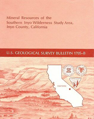
Mineral Resources of the Southern Inyo Wilderness Study Area, Inyo County, California
, Bulletin 1705-B, hard to find, first edition, 1987, by
Edwin H. McKee, James E. Kilburn, James E. Conrad, and Richard J. Blakely (U. S. Geological Survey) and Charles Sabine, Eric E. Cather, Lucia Kuizon and Michael C. Horn (U.S. Bureau of Mines); publisher: Department of the Interior, U. S. Geological Survey, United States Government Printing Office, Washington, D.C., 28 pages, 8.5 by 11 inches. Stapled binding, stiff paper covers. One 27-inch by 21-inch map folded in pocket. Everything is in near-new excellent condition.
As always, I am
extremely
conservative about rating book condition and very detailed in listing any potential flaw, no matter how slight. You get what you pay for. Look elsewhere on ebay, if you want a trashed book — filled with scribbled notes, dog-eared pages and underlined passages that the seller just "somehow forgot" to tell you about in his ad.
Payment methods and domestic shipping
Paypal only. I pride myself on bulletproof packaging.
The fine print:
Feel free to contact me if you have any questions about the item or terms of sale.
I post feedback once a week. Not responsible for typographical errors.
Good luck and thanks for looking!
We have many MANY more rare mining books! Just visit our ebay store, Rare Mining Books:
http://stores.ebay.com/Rare-Mining-Books?_rdc=1
Where is it?
This section of the Inyo Mountains is about 220 highway miles northeast of Los Angeles, California; nearest town with services is Lone Pine, about 5 miles away. (The tiny town of Keeler, on the northeast edge of Owens Dry Lake is closer, but lacks any services except for a pay phone and post office.)
This area is about 30 miles from the Inyo County seat of Independence and 60 miles from Kern County. Part of the area is a few miles from the new mid-western boundary of Death Valley National Park, but the area is NOT inside the park, so national park prohibitions against mineral collecting and mining DO NOT apply.
Nearest towns with supermarkets and chain stores are Ridgecrest and Bishop, CA, both about 75–80 highway miles away. This section of Inyo Mountains is — for many miles in all directions — chiefly unpopulated mountain and desert wilderness. Although the mining district is only accessible by dirt roads and trails, some are plainly marked on the Auto Club of Southern California Death Valley road map, so that road map can be used to correlate some exact mileages to mines and other geologic features on maps from this report.
Nearby counties
Nearby counties include: Riverside, Orange, Los Angeles, Santa Barbara, Kings, Madera, Mariposa, Tuolumne and Alpine.
Towns, population areas and interesting sites in or near Inyo County include Aberdeen, the Alabama Hills, Ancient Bristlecone Pine Forest, Argus, Badwater, Ballarat, Big Pine, Bishop, Bullfrog, Cartago, Cerro Gordo, China Lake Naval Weapons Center, Cottonwood Lakes, Coso Junction, Darwin, Death Valley Junction, Dolomite, Dunmovin, Eureka Sand Dunes, Fossil Falls, Furnace Creek, Greenwater, Haiwee Reservoir, Independence, Inyokern, Keeler, Laws, Lake Sabrina, Little Lake, Lone Pine, Mt. Whitney, Olancha, Owens Lake, Onion Valley, Panamint Springs, Pearsonville, petroglyphs, Rhyolite, Saline Valley, Scotty's Castle, Shoshone, Sierras, Sierra Nevada, Stovepipe Wells, Swansea, Trona geology mining mines stock certificate, Tecopa, Ubehebe Crater, Whitney Portal.
Good luck and thanks for looking!!!
Track Page Views With
Auctiva's FREE Counter


